Quantrill's 1863 Lawrence Raid

I met Chris Edwards as a result of our membership in the civil War Round Table of Kansas City. The more I learned about Chris, the more I knew he would be interesting in collaborating on this tour of Quantrill’s raid on Lawrence, Kansas. In 1999, Chris released the CD, Blood on the Border: The War Between Missouri and Kansas, a musical story of Confederate Colonel William C. Quantrill’s Partisan Rangers.
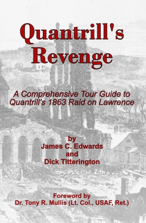
The result of our collaboration was the book, Quantrill’s Revenge: A Comprehensive Tour Guide to William C. Quantrill’s Raid of Lawrence, Kansas, which we released in August 2017. This online tour is not a substitute for buying our book, which is available in the Amazon catalog. But it will give you an idea of what the tour covers and provide access to high resolution versions of the tour’s maps.
To further convince you to buy our book, I offer up the following excerpt of the book’s foreword, written by Dr. Tony R. Mullis (Lt. Col., USAF, Ret.)
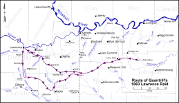
This volume is meticulously researched and documented as are the other works on the era, but it is different and more useful in one key area. It supplies the individual who has a personal or a professional interest in the attack on Lawrence in August of 1863 with just enough data and options to design his or her tailored experience. Like all good tour books or staff ride guides, Chris Edwards and Dick Titterington have organized the book to enhance the individual’s or group’s experience in under-standing the scope and details of the raid. It takes the reader from Quantrill’s first rendezvous site near Columbus, Missouri into Kansas to Lawrence and details Quantrill’s egress back to Missouri where his gang dispersed after traversing close to 175 miles over a four day period on foot and on horseback. The authors provide detailed directions to get the guide’s user to the right location to best experience the Quantrill’s route. Edwards and Titterington then provide an orientation to ensure the user has a complete appreciation for what he or she is experiencing. They do a superb job of letting the user know what has changed since 1863 and what to look for from each of the 49 stops on the complete tour. Once the reader is oriented, Edwards and Titterington describe what happened based on extensive primary and secondary sources. They then provide an objective analysis of the events associated with a particular location and explain its significance. They conclude each section with a vignette or two to capture the perspectives of those who were there during the raid. The authors document their sources and provide a most beneficial bibliography for those who want to know more about a particular topic or event. The detailed maps and images effectively complement the guide’s narrative.
Online Tour
This online tour will provide you with a list of the tour stops, along with a selection of images related to that tour stop. Associated with each tour stop is a map showing the general location of the tour stop. The map will display on your screen as a thumbnail. Click on the thumbnail to load a high resolution copy of the map.
All maps and photos are the work of Dick Titterington, aka theCivilWarMuse.
 |
Copyright © 2017 James C. Edwards and Dick Titterington, All rights reserved.
